
Features
Import Your Paddock Boundaries from a Map File
Your paddocks are already mapped in Agworld, Back Paddock, Google Earth or on a yield map from your agronomist. Don't draw them all again. Export the file, import it into P2PAgri, and every shape becomes a paddock with its name, hectares and boundary on the map.
Can I Import My Paddocks Instead of Drawing Them Again?
Yes. P2PAgri imports paddock boundaries from a shapefile, KML, KMZ or GeoJSON file and creates a paddock for each shape, with the hectares worked out from the boundary. If your boundaries already exist in an agronomy program, in Google Earth, or in the yield maps your contractor sends after harvest, you should not have to trace every one of them again by hand.
You can still type paddocks in or draw paddock boundaries on the map. Importing is the third way in, and the quickest by a long way once you have more than a handful of paddocks.
Which Paddock Map Files Can I Import?
P2PAgri imports paddocks from a zipped shapefile, KML, KMZ or GeoJSON file, the formats almost every farm mapping and precision ag program can export:
- Shapefile, zipped: a shapefile is really a bundle of files, so put the .shp, .dbf, .shx and .prj files together in one .zip and import the zip.
- KML or KMZ: the format Google Earth, Google My Maps, Back Paddock and many other programs save.
- GeoJSON: files ending in .geojson or .json, for example from geojson.io or a mapping program.
How to Import Paddock Boundaries into P2PAgri
Four steps, and nothing changes on your farm until you save:
- Open the Paddock screen for the farm the paddocks belong to and choose Import paddocks.
- Pick your shapefile zip, KML, KMZ or GeoJSON file.
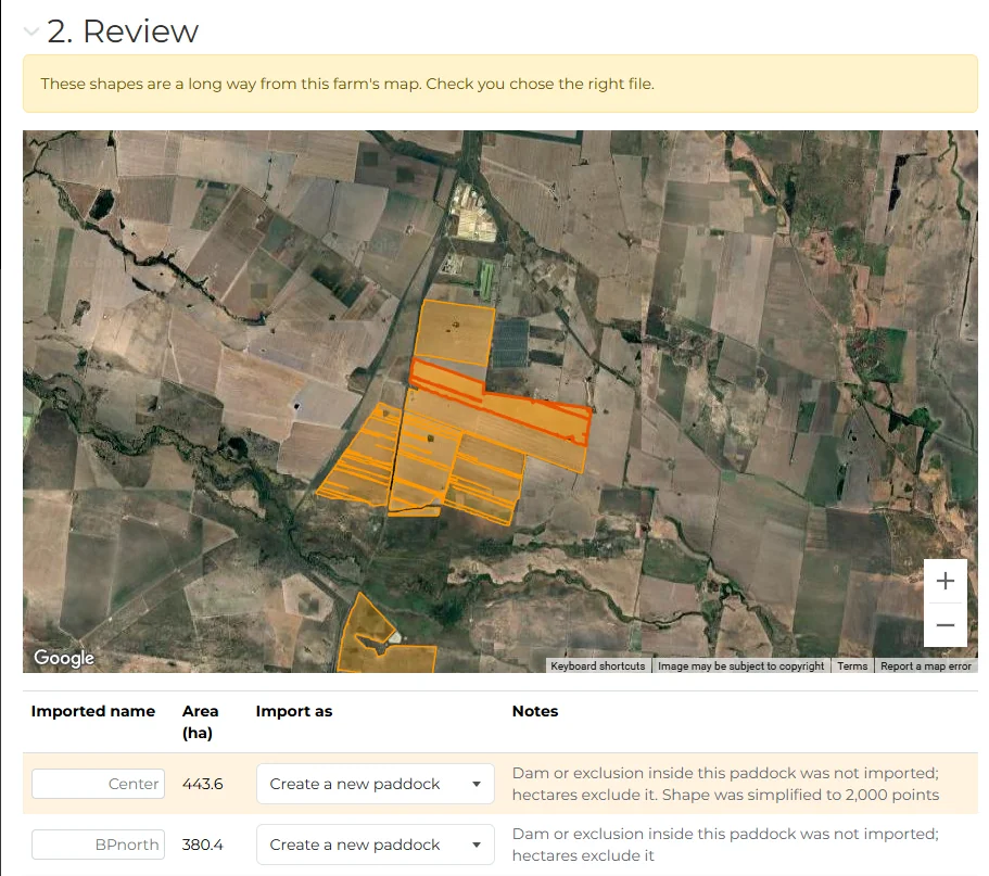
- Review the result. Every shape from the file is drawn over the paddocks you already have, alongside its name, hectares and what the import will do with it: create a new paddock, give an existing one its boundary, replace a boundary, or skip it.
- Save. Every paddock you chose is created or updated in one go, with its boundary on the map.
The import has its own short walkthrough inside the platform, so you are guided through it the first time.
How Do I Export Paddocks from Agworld, Back Paddock or Google Earth?
P2PAgri does not connect to other mapping programs directly. The file is how the paddocks come across, and every program below can produce one in a few clicks:
- Agworld: open the farm map, choose Export, then Shapefile or KML.
- Back Paddock: export your paddocks as KML.
- Google Earth (web): open your project, click the three-dot menu and choose Export as KML file.
- Google My Maps: open the map, click the three-dot menu and choose Export to KML/KMZ.
- Yield maps: ask your agronomist or precision ag contractor for the paddock files as a zipped shapefile.
Paddock names are read from the file wherever the program saved one. Agworld, Back Paddock and Google Earth all do. If a shape has no name, P2PAgri calls it Paddock 1, Paddock 2 and so on, and you can type the right name on the review screen before saving.
Your Existing Paddocks Are Never Overwritten by an Import
Every shape is matched to your existing paddocks by name. That means no duplicates, and nothing you have already set up or drawn is touched unless you tell the import to replace it:
- A paddock you have set up but never drawn takes its boundary from the file. Its figures are left alone.
- A paddock that is already mapped is skipped automatically and marked "Already mapped". Choose "Replace boundary of" on that row if you do want the file to take over.
- Anything that does not match a name becomes a new paddock.
The totals at the bottom of the review screen tell you exactly what Save is about to do: how many paddocks will be created, how many existing ones get a boundary, and how many shapes are being skipped. If any part of the import cannot be saved, nothing is saved and the screen tells you which row caused it, so you never end up with half a file imported.
Turn a Yield Map into Paddock Boundaries
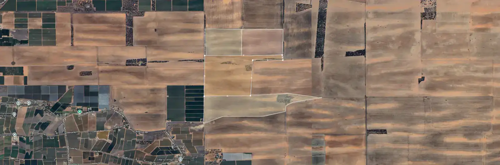
P2PAgri turns a season's worth of yield maps into a full set of paddock boundaries in one import. The yield maps your precision ag contractor sends after harvest usually come as one shapefile per paddock, each made up of hundreds of small yield zones and no paddock name. P2PAgri recognises that layout. The zones are joined into a single outline per paddock, small gaps between zones are closed, and the paddock is named from the file name with the year taken off, so 2025_Woolshed.shp becomes a paddock called Woolshed.
Accurate Paddock Hectares, Whatever Program the File Came From
The area of every imported paddock is calculated from its boundary using the same maths the map uses when you draw by hand, so imported and drawn paddocks sit side by side with consistent figures. A few things the import takes care of:
- Whatever map projection your file uses, the import converts it so the paddocks land in the right place on the map. You do not need to know which projection it is.
- A dam or house block cut out of a paddock in the file is left out of the hectares, even though the map draws the paddock as one outline.
- A paddock stored as two separate pieces comes in as two paddocks, Home 1 and Home 2, so nothing is lost. Rename them on the review screen if you prefer.
- Points and lines in the file, such as trough markers or fence lines, are ignored. Only areas become paddocks.
- If the shapes sit a long way from the farm's location, the import warns you before you save, in case you picked the wrong file or the wrong farm.
Imported Paddocks Flow Straight into Your Gross Margins
Imported paddocks work exactly like paddocks you drew by hand. Set what each one is running this year in Production Cycles, and the hectares flow straight into crop gross margins per hectare, stocking rates in DSE per hectare, pasture carrying capacity and the colour-coded profitability overlay on the farm map.
Get Started
Paddock import is part of farm mapping on the Seasonal plan. Create your free P2PAgri account, choose Seasonal, and bring your paddocks across in one import.
FAQ
Frequently Asked Questions
Yes. In Agworld open the farm map, choose Export, then Shapefile or KML. Then go to SEASON > Paddock in P2PAgri, click Action and choose Import paddocks. Paddock names come across with the shapes.
Zipped shapefiles (.zip containing .shp, .dbf, .shx and .prj), KML, KMZ and GeoJSON (.geojson or .json). Files up to 10 MB with up to 500 shapes can be imported at a time.
Files up to 10 MB with up to 500 paddock shapes can be imported at a time. If your export is bigger than that, split it into a few smaller files and import them one after the other.
No. A spreadsheet has no boundary outlines in it. Use a shapefile, KML, KMZ or GeoJSON export instead. If all you have is a list of names and areas, type them into the Paddock Specifications table on the Paddock screen.
No. A paddock that already has a boundary is skipped unless you choose "Replace boundary of" for it on the review screen. Paddocks you have set up but never drawn simply gain their boundary; their figures are untouched.
Yes. Zip the shapefiles it came with and import the zip. Each paddock's yield zones are joined into one outline, small gaps are closed, and the paddock is named after the file, so 2025_Woolshed becomes a paddock called Woolshed. Because the gaps are filled in, the hectares can read a little above the yield report's total; adjust the area on the Paddock screen if you want the report's figure.
No. It brings in the paddock name, its area and its boundary. What each paddock is running this year is set in Production Cycles on the Paddock screen, the same as for any paddock.
A map file carries no ownership or soil information, so every new paddock arrives as Owned with a Loam soil type. Change either on the Paddock screen once the paddocks are in.
The zip is missing its .prj file, which tells the import where the shapes sit on the earth (for example GDA2020 MGA zone 54, GDA94 or WGS84). Export the shapefile again and include every file that came with it, or export as KML instead, which needs no projection file.
Paddock import is part of farm mapping on the Seasonal plan. The free Essentials plan does not include the Paddock screen, so the import is not available there.
Explore More
Key Capabilities for Your Farm Business
Map Your Paddocks & Track Your Rainfall
Farm Mapping
P2PAgri’s farm mapping tool uses Google Maps satellite imagery to let you draw your paddock boundaries, calculate areas,...
Learn moreOptimise Crop Profitability
Crop Gross Margin Analysis
Knowing your gross margin per hectare is the foundation of every cropping decision. Which paddocks are earning their pla...
Learn moreImprove Profitability for Livestock & Pasture
Pasture Management
Are you running at the right stocking rate? Too many stock and you degrade your pastures. Too few and you're leaving mon...
Learn moreFarm Financial Planning & Cash Flow
Farm Business Dashboard
One screen that shows you how your farm business is tracking. P2PAgri's dashboard is your command centre, key metrics, v...
Learn moreImport Your Farm Accounting Data from Any Software
Accounting Data Import
You don't need to switch accounting software to use P2PAgri. Connect Xero directly, or export your Profit and Loss and B...
Learn more